I was a GIS research assistant for Simon Burrows's AHRC project on the French book trade across late-Enlightenment Europe (FBTEE). From 2007 to 2012, Simon Burrows, Project Director, and Mark Curran, Research Fellow, collected data about 400 000 copies of around 4000 books. Henry Merivale provided technical advice (in particular to build the database search interface). To learn more about the project, you can also have a look at this blog.
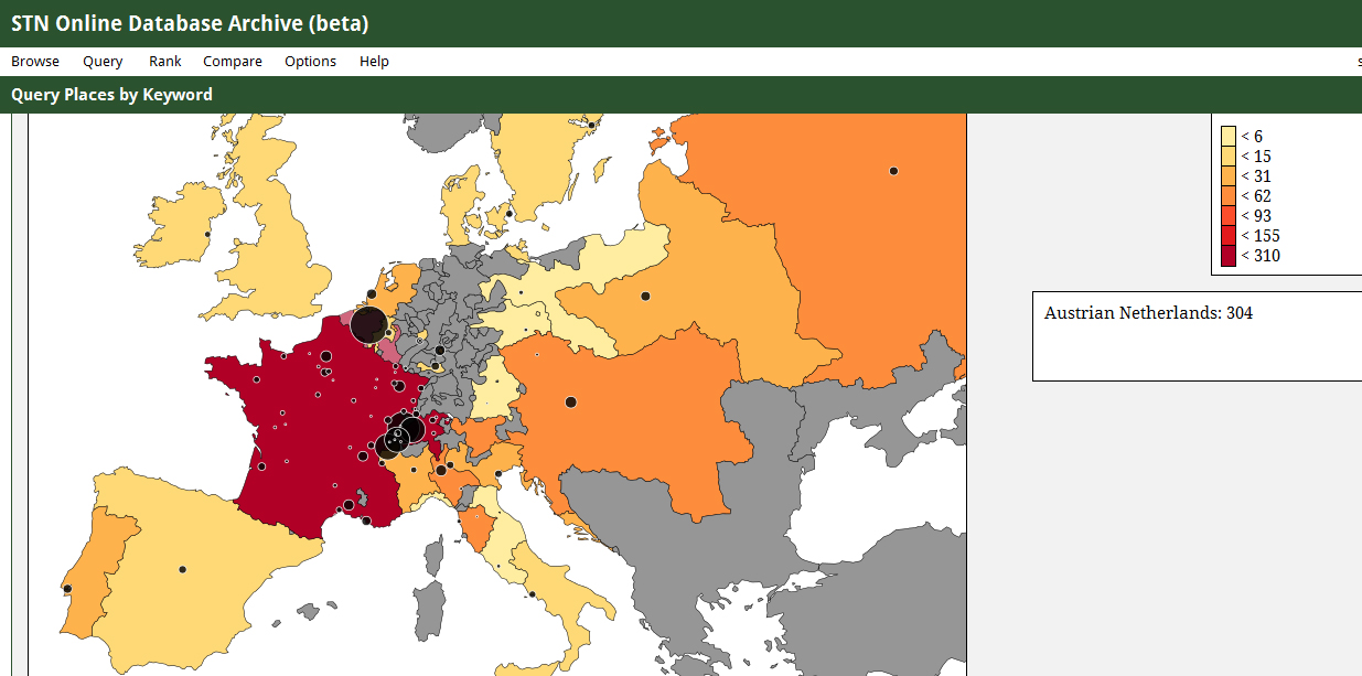
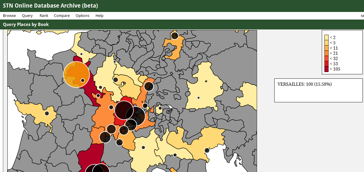
My own role was to develop maps based on the Societe Typographique de Neuchatel database. The maps produced from the database illustrate various trends and patterns present in the European public sphere in the second half of the eighteenth century. You can find below two static examples of maps I have created for the database (ask Simon Burrows's permission if you want to use them). The interface has been online since June 2012 and can generate maps of any books sold by the Societe Typographique de Neuchatel. For example, have a look at this map of the sales of the Encyclopedie from 1769 to 1794. To see other visualisations I have created for this project, click here.
My work has been reviewed by Robert Darnton in his review of the FBTEE project:
"The FBTEE’s finest feature is its maps. Color-coded and carefully demarcated according to different boundaries, they make it possible to enjoy a broad overview of trade patterns and to zoom in to individual sites, where one can assess the relative importance of factors such as trade routes, political barriers, and cultural institutions. The design and engineering, done by Vincent Hiribarren, builds on a tradition that goes back many years to the ‘laboratoire cartographique’ of the Ecole des hautes études en sciences sociales, but it belongs to the current flourishing of the digital humanities – that is, the study of cultural data that can be aggregated on a large scale, broken down into pertinent units, recombined to bring out hidden relations, and expressed visually, thanks to the latest advances in information technology."
Only based on files in the public domain found on Natural Earth, Simon Burrows and I patiently reconstructed for this project the complexity of eighteenth-century Europe with the help of various atlases and eighteenth-century maps. We first modified twenty-first century borders with a GIS software before turning our maps into GeoJSON files. These maps are available on the project website in shp and GeoJSON formats.
Selected Bibliography
- 'David Rumsey Map Collection' [accessed 2 July 2012]
- 'Des Villages Cassini Aux Communes D’aujourd’hui' [accessed 2 July 2012]
- Brewer, Cynthia, Designing Better Maps: A Guide for GIS Users (Esri Press, 2005)
- Brunet, Roger, La Carte Mode d’Emploi (Fayard, 1987)
- Great Britain Historical GIS, 'A Vision of Britain Through Time' [accessed 2 July 2012]
- Gregory, Ian, and Paul Ell, Historical GIS: Technologies, Methodologies and Scholarship (Cambridge University Press, 2007)
- Gregory, Ian, and Richard Healey, ‘Historical GIS: Structuring, Mapping and Analysing Geographies of the Past’, Progress in Human Geography, 31 (2007), 638 –653
- MacDonald, B. H., ‘Using GIS for Spatial and Temporal Analyses in Print Culture Studies: Some Opportunities and Challenges’, Social Science History, 24 (2000), 505–536
- Nordman, Daniel, and Marie-Vic Ozouf-Marignier, Atlas De La Révolution Française, Librairie Du Bicentenaire De La Révolution Française (Éditions de l’École des hautes études en Sciences Sociales, 1989)
- Sellier, André and Jean Sellier, Atlas Des Peuples d’Europe Centrale (La Découverte, 2002)
- Sellier, André, Jean Sellier and Anne Le Fur, Atlas Des Peuples d’Europe Occidentale (La Découverte, 2006)


